

Names of the village
- 1295 – Vorwerk des Gesco – this name appears for the first time in the documents of Duke Bolko of Opole.
- 1530 – Forwerckh – name mentioned in a book published in 1830 by Knieja, probably on the basis of Habsburg documents (1526–1740).
- 1742 – Folwark – on the basis of the seal.
- 1830 – Follwark – in the urbarial records.
- 1936 – Vorwerk – after Hitler came to power.
- 1945 – Folwark – after the Second World War.
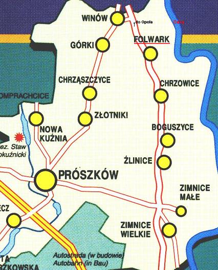
The village lies on national road no. 45 Opole – Racibórz. The Katowice – Wrocław motorway can be reached “normally, that is, within the rules” in 8 minutes. The average number of inhabitants is 250, and has changed little in 100 years.
- 1830 – 142 inhabitants, 27 houses
- 1845 – 160 inhabitants, 25 houses
- 1870 – 271 inhabitants
- 1944 – 388, of whom 68 were killed and 88 remained abroad
- 1945 to 1947 – 232 inhabitants (a changing number)
- 1994 – 220 inhabitants
The distance to the city limits of Opole is about 2500 metres, to the Oder about 500 metres. It is 6 km to the centre of Opole. The neighbouring villages are Chrzowice, parish Chrząszczyce, Górki and Winów.
When the Oder was still in the first class of water purity, one could swim across to the other bank and visit the inhabitants of Groszowice.
It is about 11 km to the municipal office in Proskau (Prószków). Today Prószków is “the town of Prószków”.