

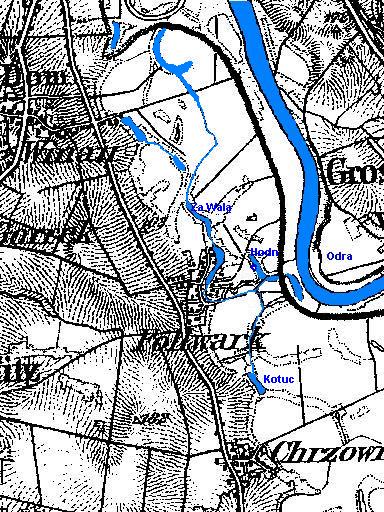
Topographic map made in 1883 (corrections were added in 1930).
A large lake is visible in the centre of Folwark. The lake “Hodne” reaches the flood embankment, which was built in the 1860s. The corresponding orders concerning the regulation of the Oder had been issued 123 years earlier, in 1737, by Frederick William I (1688–1740). Our Folwark still belonged to the Habsburgs then. Behind the embankment this lake no longer exists today. The lake “Za Walą” has also shrunk.
On this map one can see how far the water came during the famous flood of 1997. These light (white) areas were under water. The whole of ul. Wiejska, and from the north the water reached ul. Szkolna. The normal water level in our lake is 152 m above sea level, exactly as high as the Oder at Folwark. At Chrzowice the level of the Oder is 153 m above sea level. Ul. Szkolna lies at an average height of 160 m, and the Opole – Racibórz road at 162 m above sea level. For the curious I can add that the church in Chrząszczyce stands at 191 m above sea level.
The land around Folwark looked interesting in 1736. In the castle at Rogów Opolski there is a map “PRINCIPATUS SILESIA OPOLIENSIS MDCCXXXVI”, on which we see that the land from the lake “Kotuc” to the Oder, between Folwark and Chrzowice, was covered with oak trees. A similar forest lay on the north side, between the Oder and the road (today national road no. 45), almost as far as the borders of Opole. Our “Lake” stretched to the lake Kotuc in the south and in the north to Wójtowa Wieś, and was further connected with the Oder. The Hodne lake was connected with the lake Za Walą. Today’s Przewrócie was an island.
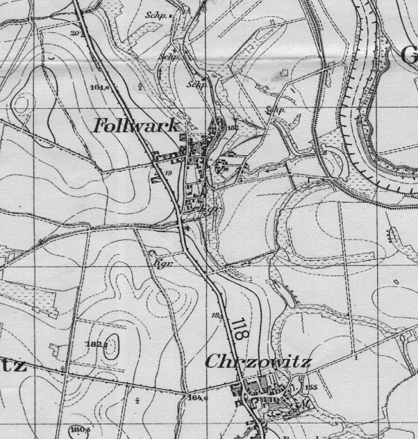
Map from the year 1900